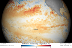
The El Niño climate pattern is expected to be the dominant driver of weather patterns through the coming seasons, potentially bringing below-normal precipitation to the northern Intermountain West during the 2027 water year, according to seasonal outlooks from the Climate Prediction Center.
Understanding the ENSO Pattern
According to a diagnostic discussion from the NOAA Climate Prediction Center, El Niño and La Niña represent the warm and cool phases of the El Niño-Southern Oscillation, or ENSO, a recurring climate pattern occurring across the tropical Pacific. This pattern shifts irregularly every two to seven years, triggering predictable disruptions in temperature, precipitation, and winds by disrupting large-scale air movements in the tropics and causing global side effects.
Seasonal Forecast Trends
A monthly outlook discussion released on Oct. 15, 2026, noted that El Niño is expected to be the dominant climate driver, overshadowing the Madden-Julian Oscillation (MJO), though localized sea surface temperature influences remain possible. While current El Niño conditions are forecast to strengthen, the month of November may serve as a transition period for ENSO impacts in some regions, with teleconnections expected to strengthen through the winter months.
Precipitation Outlook for the West
The precipitation outlook for November 2026 indicates a spatially consistent signal for below-normal precipitation across the northern Intermountain West, a trend that aligns with El Niño patterns. However, there is uncertainty regarding the exact northward extent of this signal along the West Coast, resulting in an equal chances designation for some coastal areas due to high model spread.
Forecasting Methodology
The Climate Prediction Center uses various tools to generate these forecasts, including dynamical models, local sea surface temperature anomalies, and decadal trends. Specifically, the November 2026 outlook incorporates multi-model ensembles from the Copernicus Climate System (C3S) and the North American Multi-Model Ensemble (NMME), alongside probability anomaly correlation (PAC) calibrated NMME forecasts.
Model Agreement and Uncertainty
Forecast accuracy relies on several short-term models, including the Climate Forecast System version 2 (CFSv2), the Global Ensemble Forecast System version 12 (GEFSv12), and the European Centre for Medium-Range Weather Forecasts (ECMWF) models. Additionally, monthly forecasts from the CFSv2 and the experimental beta version of the Seasonal Forecast System (SFS) model are utilized in the planning process.
Temperature and Precipitation Divergence
While the precipitation outlook for the northern Intermountain West suggests below-normal levels, temperature outlooks for November 2026 show enhanced above-normal probabilities across the northern two-thirds of the Contiguous United States. This warmer trend is particularly likely over the Northern Plains, the Upper Mississippi Valley, and the Great Lakes, though inter-model spread increases uncertainty in other regions.
Climatological Standards
The Climate Prediction Center issues official 90-day outlooks once each month near mid-month at 8:30 a.m. Eastern Time. These seasonal outlooks are based on departures from the 1991-2020 climate reference period, which follows the World Meteorological Organization convention of using the most recent three complete decades to better represent shorter-term climatic anomalies.