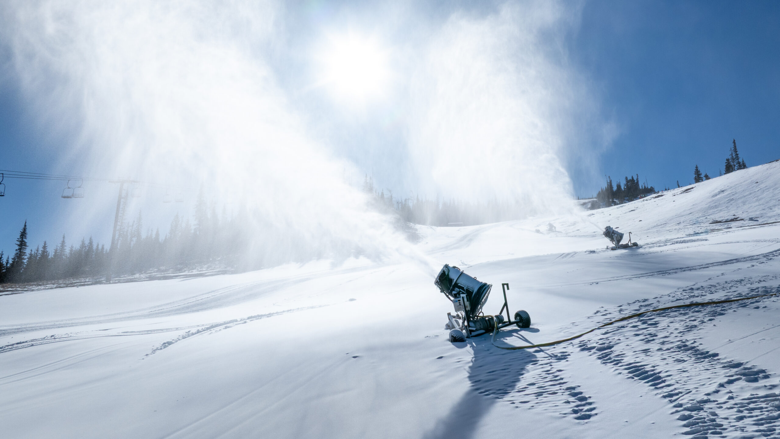
A powerful, moist storm system is forecast to bring plentiful rain and high-elevation snow to Utah this weekend, according to OpenSnow. Forecasters predict significant snow for the state's high peaks and a drop in snow levels as a cold front moves through the Rockies, following a summer of infrastructure upgrades at southern Utah resorts like Brian Head.
Weekend Weather Patterns
The storm cycle is expected to impact a wide area from Friday, October 30, 2026, through Monday, November 2, 2026. While the system will start with warm air in place, causing rain at higher elevations in many areas, a cold front is expected to arrive later in the weekend. This front will cause snow levels to dip to lower altitudes behind it, particularly as the storm moves inland across the Rockies.
Friday and Saturday Forecast
On Friday, October 30, 2026, a leading-edge shortwave is expected to bring light showers to the Southwest, the Sierra, and the Western Rockies, including areas from Utah to Idaho. During this initial stage, snow levels are expected to remain high, which may result in rain reaching mid-mountain or higher for several ski areas.
By Saturday, October 31, 2026, light showers will continue across the Rockies as the shortwave exits. Meanwhile, the main, stronger storm is expected to reach California, where heavy rain and snow will develop, specifically hitting the Sierra Nevada Range and Tahoe with its heaviest precipitation.
Sunday and Early Week Outlook
The intensity of the storm is expected to increase as it moves inland. On Sunday, November 1, 2026, rain and snow are forecast to pick up in intensity across the Rockies. While snow levels will initially remain fairly high, a cold front is expected to move through on Sunday night, bringing lower snow levels to the region.
As the center of the storm exits the Rockies toward the plains, a colder northwest flow is expected on the backside of the storm. This setup, combined with colder temperatures, should favor additional snowfall across Colorado and parts of Wyoming between Monday, November 2, 2026, and Tuesday, November 3, 2026.
Utah Resort Snow Totals
OpenSnow's forecast for Utah resorts highlights significant accumulation for high-elevation locations. Predicted snow totals for the next five days range from 12 to 24 inches for favored ski resorts in Utah.
Specific snowfall totals for various Utah locations include:
28 inches for Snowbird
27 inches for Alta
21 inches for Brighton
13 inches for Solitude
11 inches for Park City
9 inches for Deer Valley
6 inches for Powder Mountain
6 inches for Snowbasin
5 inches for Beaver Mountain
3 inches for Sundance
0 inches for Cherry Peak and Nordic Valley.
Brian Head Infrastructure Upgrades
At Brian Head Resort, the upcoming snow arrives following significant infrastructure investments made during the summer of 2026. The resort has been working on snowmaking upgrades to ensure a stronger start to the winter season and to increase the efficiency of their operations.
As part of these upgrades, a new pipeline is being implemented that is capable of moving up to four times more water to the Navajo side of the resort. This project effectively doubles the snowmaking capacity for that area, allowing the mountain operations team to better utilize cold-weather windows and build a more consistent base across a larger footprint of the mountain.
Extended Long-Range Outlook
Looking further ahead, a secondary storm pattern may develop during the second half of next week. Between Wednesday, November 4, 2026, and Sunday, November 8, 2026, one to two additional storms are possible across the Southwest, which could potentially bring snow to the Four Corners region and the eastern mountains of Colorado.
Currently, confidence remains low regarding snow potential for the Sierra Nevada during that later period, while the Northwest U.S. and Northern Rockies are expected to see drier conditions. In the East, weather patterns are expected to remain warm with well above average temperatures and minimal snow potential.
Brian Head Local Conditions
For Brian Head, the current forecast for Friday, October 30, 2026, shows a temperature of 32 degrees Fahrenheit with wind speeds of 25 mph and gusts reaching up to 50 mph. The precipitation chance is high, with a 94% to 96% chance of precipitation reported for the area during the day.