Hurricane Isaias has intensified into the Atlantic season's first hurricane, maintaining maximum sustained winds of 80 mph as it moves east-northeast toward the northern Gulf Coast. The National Hurricane Center reported the storm's upgrade at 3:30 UTC on Thursday, Oct. 8, 2026, after aircraft found 76-knot boundary layer average winds in the southwest quadrant of the system.
Intensification Amid Wind Shear
The intensification occurred despite the presence of moderate westerly vertical wind shear, which has been impinging on the storm's circulation. While the Tail Doppler Radar indicated some northward tilt with height, the circulation has become more aligned than during previous missions. A NOAA-P3 aircraft has been conducting in-situ sampling, confirming that Isaias continues to intensify.
Forecasted Strengthening and Path
Forecasters anticipate Isaias will continue to strengthen, potentially reaching near major hurricane intensity within the next 24 hours. The storm is currently located about 385 miles southwest of the mouth of the Mississippi River, moving at 9 mph. While vertical wind shear is expected to ramp up to 40-50 knots in the 12 to 24 hours before landfall—which may lead to some weakening—the hurricane's wind field may become broader and more asymmetric due to interaction with a short-wave trough.
Projected Landfall and Transition
The National Hurricane Center's track forecast indicates the storm will turn toward the northeast and then toward the north over the next 24 to 48 hours. Isaias is expected to pass to the north of the Yucatan Peninsula later today and make landfall along the U.S. northern Gulf Coast late Friday or early Saturday. Following landfall, the system is expected to move inland and transition into a post-tropical low over the Tennessee Valley.
Alabama Declares State of Emergency
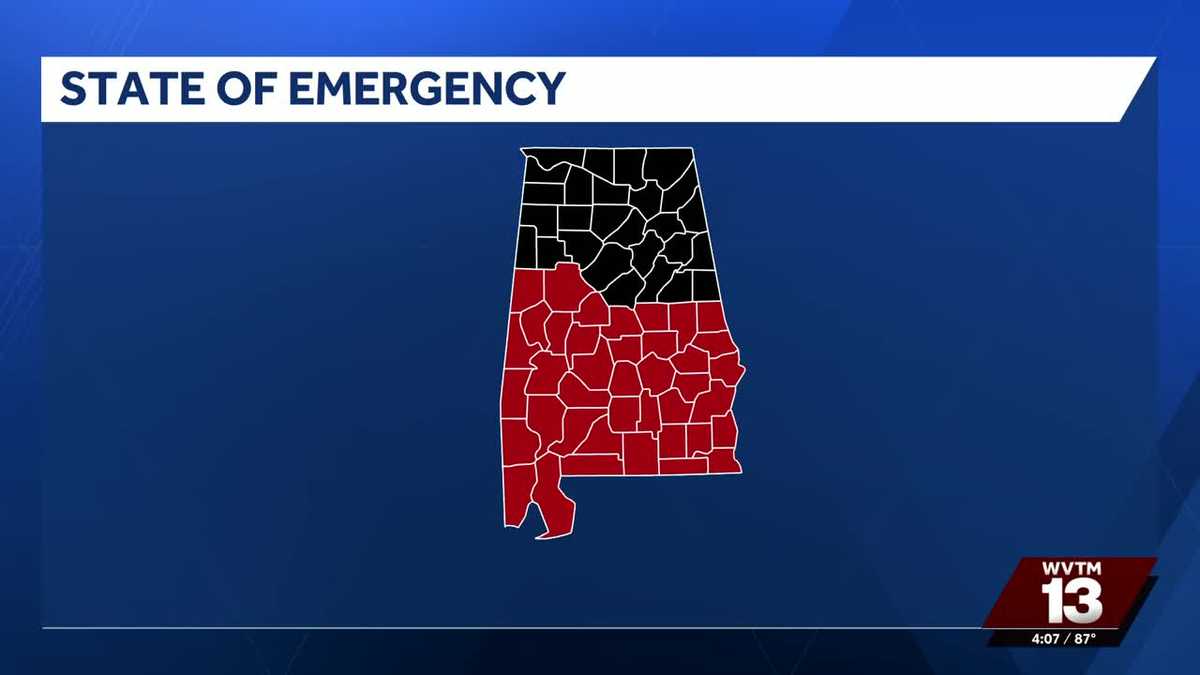
In response to the developing threat, Alabama Governor Kay Ivey declared a state of emergency for 40 counties on Wednesday, Oct. 7. The proclamation, which took effect at 4 p.m. Central on Oct. 7, remains in effect for seven days and is scheduled to expire at 11:59 p.m. on Oct. 14 unless otherwise ordered. The order allows state agencies to assist communities, helps assess damage, and authorizes the Alabama National Guard to prepare for activation.
Scope of Emergency Proclamation
The state of emergency covers a wide range of Alabama counties, including Autauga, Baldwin, Barbour, Bibb, Bullock, Butler, Chambers, Chilton, Clarke, Choctaw, Coffee, Conecuh, Coosa, Covington, Crenshaw, Dale, Dallas, Elmore, Escambia, Geneva, Greene, Hale, Henry, Houston, Lee, Lowndes, Macon, Marengo, Mobile, Monroe, Montgomery, Perry, Pickens, Pike, Russell, Sumter, Tallapoosa, Tuscaloosa, Washington, Wilcox, and others. The proclamation also addresses potential price gouging and waives certain federal motor-carrier regulations to speed the movement of emergency supplies.
Life-Threatening Hazards
The National Hurricane Center has issued several life-threatening warnings for the Gulf Coast. A Storm Surge Warning is currently in effect from the mouth of the Mississippi River to Steinhatchee, Florida, creating a danger of life-threatening inundation. Additionally, a Hurricane Warning is in effect from Ocean Springs, Mississippi, to the Bay/Gulf County Line in Florida. Residents in these warning areas are advised to rush preparations to completion.
Rainfall and Tornado Risks
In addition to storm surge and wind, Isaias is expected to bring heavy rainfall to the central U.S. Gulf Coast and much of the Southeast from Friday through the weekend. Rainfall totals could reach 3 to 7 inches, with localized amounts as high as 10 inches. The storm may also trigger isolated tornadoes on Friday night in coastal areas of Alabama, the Florida Panhandle, and far southwestern Georgia, with the threat continuing into Saturday for eastern Alabama, Georgia, and northern Florida.