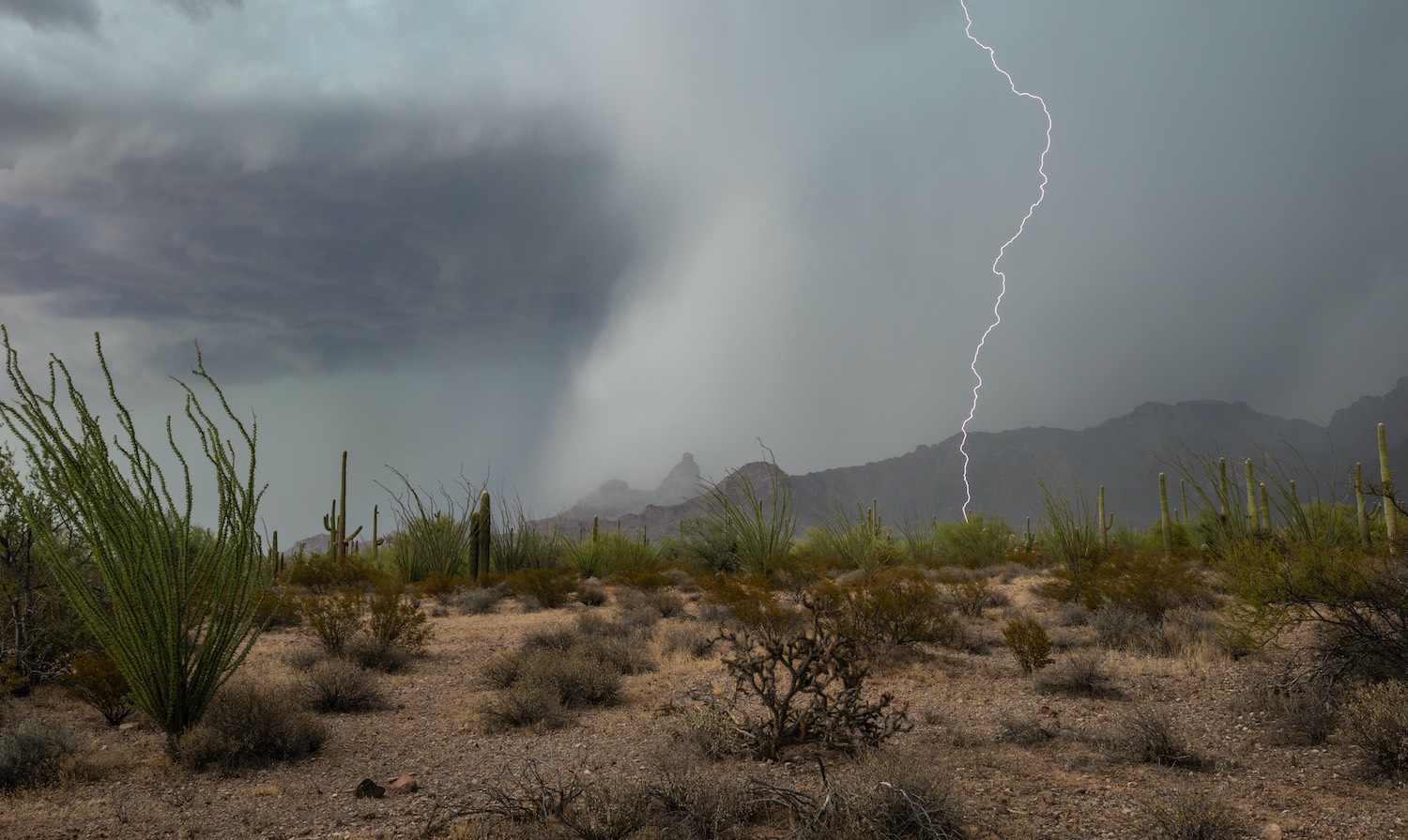
North American Monsoon: Above-Average Seasonal Rainfall Is Likely, Bringing Potential Drought Relief.The North American Monsoon brings summer precipitation to parts of the Southwestern U.S. and Mexico. The monsoon season is June 15 to September 30, though the actual arrival of the monsoon can vary.
Key PointsThe North American Monsoon seasonal forecasts are leaning toward above-average overall precipitation this summer.Above-average rainfall totals will improve short-term drought conditions in the Southwest U.S. Long-term drought impacts, especially the ongoing impacts from last winter’s record-low snowpack, will remain. The monsoon will likely have little influence on streamflow in the Colorado and Rio Grande Rivers.Reservoir levels across the region will likely not see substantial change from monsoon season rainfall. Sea surface temperatures in the Gulf of California, which are already above normal at 84°F (29°C), often influence the monsoon weather activity.There is no clear pattern on the influence of El Niño on summertime weather in the Southwest U.S. However, as El Niño develops, the chances for tropical storm development in the eastern Pacific increase. Decaying tropical storms can contribute to deep surges of moisture that can move into the interior Western U.S. More information and background about the North American Monsoon is available from the National Weather Service offices across the Southwest and the Climate Assessment for the Southwest (CLIMAS, a NOAA RISA team) at the University of Arizona. This update is based on data available as of Thursday, June 18, 2026 at 8:00 a.m. MT. We acknowledge that conditions are evolving.
Current Conditions
Satellite Imagery of a Typical Monsoon Pattern
Typical Monsoon Pattern
Water vapor satellite imagery showing a “typical” monsoon pattern. Areas of dark blue, green, and red represent thunderstorms, while deeper orange areas represent dry air. With upper level high pressure east of New Mexico, the clockwise flow around the high results in moisture being transported north from Mexico into portions of New Mexico and Arizona. Thunderstorms that form under this regime will move from south to north or southwest to northeast.
Source(s):
National Weather Service Albuquerque Weather Forecast Office
Legend
Thunderstorms
Dry Air
About
Updates
Last Updated:
06/18/26
North American Monsoon information from the Albuquerque Weather Forecast Office:
Learn More
Main Stats
84°F (29°C)
sea surface temperature in the southern Gulf of California
50–75%
of annual rainfall typically received during the monsoon season in parts of Arizona and New Mexico
June 15
is the official start of the monsoon season
92%
of Arizona and New Mexico are currently in drought
In This Update:What is the North American Monsoon, and How Does It Impact Drought in the Southwest?What Are Current Drought Conditions Going into Monsoon Season?Outlooks and Potential Impacts on Drought in the Southwest U.S.Additional ResourcesWhat Is the North American Monsoon, and How Does It Impact Drought in the Southwest?The North American Monsoon is a seasonal wind shift that typically occurs between June 15–September 30 (monsoon season), depending on geographic location. The monsoonal flow allows moisture to move into the Southwestern U.S., which provides a needed ingredient for thunderstorm activity.This pattern results in active thunderstorms across Arizona, New Mexico, Colorado, and southern/eastern Utah. Monsoonal surges can also occur outside of these "core" areas, reaching Nevada, southeastern California, Far West Texas, and Wyoming.Rainfall associated with the monsoon is very important for the Southwest U.S. Parts of Arizona and New Mexico receive as much as 50-75% of their annual precipitation during the monsoon season (June-September).The monsoon can be a hinge-point for short-term drought in the Southwest. An ample monsoon will relieve short-term drought impacts by increasing soil moisture, instigating grass growth and green-up, and decrease evaporative demand due to increased cloud cover.A scant monsoon season will worsen drought conditions as temperatures remain high throughout the season and what little rain may fall will evaporate quickly.Monsoonal rains don’t usually raise reservoir levels, but can slow reservoir drawdown as water demand usually drops during active monsoon periods. As such, long-term drought along the Colorado River will continue regardless of monsoon activity.Not every place gets monsoonal rainfall equally:Higher elevations get more frequent storms and more total precipitation than low valleys.For example, July precipitation totals in Flagstaff are often double the Tucson total and sometimes triple the Phoenix total, on average.The monsoon also influences wildfire risk. Dry lightning, or cloud-to-ground lightning from storms without any accompanying precipitation, is a major source of wildfire ignition in the Western U.S. during the early monsoon season.Later in the season, when wetting rains are plentiful, the monsoon reduces (and in some cases eliminates) wildfire risk, freeing up firefighting resources to help in other regions. In recent history, there has been a tendency for above-average monsoon seasonal rainfall to follow dry winters. A 2025 study also showed that dry soils lead to an earlier monsoon onset by about a week while wet soils can delay the onset by about a week. Higher Elevations Get More Frequent Storms than Low Valleys
Precipitation totals for July through September across the Southwest U.S., based on the 1991-2020 average. Higher elevations receive the highest average precipitation. Data Source: PRISM. Accessed through ClimateEngine.org.
Current Drought Conditions and ImpactsAs of June 16, 90.9% of the Southwestern U.S. states (Arizona, Colorado, Nevada, New Mexico, and Utah) are in drought, according to the U.S. Drought Monitor.Long-term drought in the Southwest U.S. has been influenced by an ongoing megadrought that has impacted the Western U.S. for the last two and a half decades, as well as the record-low seasonal snowpack from the 2025-26 winter.Snow water equivalent across the Western U.S. on April 1, the usual peak date, was 32-53% lower than the previous record low during the SNOTEL era.Unprecedented snow drought is expected to lead to critical water shortages in reservoirs along the Colorado River and across the Southwest U.S. Water-year-to-date precipitation (since October 1) across the Western U.S. ranges from near average to more than 10 inches below average.Water Year Precipitation Ranges from Near Average to More than 10 Inches Below Average for the Southwest U.S.
Precipitation difference from average (in inches) for the water year to date (October 1, 2025–June 14, 2026) based on GridMET daily 4km precipitation data. Anomalies are computed using the 1991–2020 long-term average. Teal hues indicate above-average precipitation, and brown hues indicate below-average precipitation. Source: ClimateEngine.org
Warm Waters in the Gulf of California Provide Monsoonal Moisture
Sea surface temperatures (°C) for the eastern Pacific Ocean, including the Gulf of California. Valid June 16, 2026. The two axes show the latitude and longitude, while color indicates the sea surface temperature at that location. Blue and purple hues indicate colder temperatures, while yellow, orange, and red hues indicate warmer temperatures.Source(s): NOAA Office of Satellite and Product Operations.
Outlooks and Potential ImpactsLong-range climate models (e.g., NOAA National Weather Service Climate Prediction Center Outlooks, North American Multi-Model Ensembles) predict above-average rainfall for the monsoon season.Short-term drought impacts, such as dry soils and high fire danger, may be temporarily removed by an active monsoon.Long-term drought impacts, especially the ongoing impacts from last winter’s record-low snowpack, will remain. The monsoon will likely have little influence on streamflow in the Colorado and Rio Grande Rivers.Reservoir levels across the region will likely not see substantial change from monsoon season rainfall. According to the National Weather Service’s Climate Prediction Center, El Niño conditions are present and expected to strengthen over the summer months. The influence of El Niño on summertime weather in the Southwest U.S. is weak and inconsistent, meaning there is not a clear pattern from one event to another. Previous studies have suggested that El Niño conditions can impact early season circulation patterns, leading to a weakened subtropical ridge, delayed onset, and below-average precipitation in late June and early July.As an El Niño develops, the chances for tropical storm development in the eastern Pacific increase. While the path of these storms is not known until they form, in the past these storms have contributed to monsoon season rainfall in the Southwest U.S. Decaying tropical storms can contribute to deep surges of moisture that can move well into the interior Western U.S. depending on upper-level weather patterns. The National Interagency Fire Center’s wildland fire potential outlook shows heightened fire risk for Arizona and New Mexico in June, when the prevalence of dry lightning tends to be highest. The same states have a near-normal wildland fire risk in July (fire potential is normally high through the summer months). The fire potential for northern Arizona, eastern Nevada, Utah, and Colorado remains high through July but lowers in August as the monsoon season progresses.Long-Range Climate Models Suggest Above-Average Monsoon Season Rainfall Is Likely
Seasonal (3-Month) precipitation outlook for July 1–September 31, 2026, showing the probability of above- (teal hues), below- (brown hues), or near-normal (gray hues) precipitation across the Southwest U.S. White areas indicate equal chances of above-, near-, or below-normal precipitation. Source: National Weather Service Climate Prediction Center. Map from Drought.gov.
The North American Multi-Model Ensemble (NMME) forecast for precipitation rate anomalies (mm/day) for July, August, and September. Green and blue shades indicate likely above-normal precipitation, and orange and red shades indicate likely lower-than-normal precipitation. Source: National Weather Service Climate Prediction Center.
Average- to Above-Average Seasonal Precipitation Will Improve but Not End Drought in the Southwest U.S.
The Seasonal Drought Outlook predicts whether drought will develop (yellow), remain (brown), improve (gray/beige), or be removed (green) from June 18–September 30, 2026. Source: Climate Prediction Center. Map from Drought.gov.
Additional ResourcesMonsoon ResourcesClimate Assessment for the Southwest (CLIMAS, a NOAA RISA Team) | MonsoonArizona Summer Monsoon Season Precipitation MappingNew Mexico Summer Monsoon Season Precipitation MappingNIDIS Intermountain West June 16 Drought Update and Outlook Webinar (includes a North American Monsoon update)Local NOAA National Weather Service information on the monsoon:2026 Monsoon Awareness Week Story MapTucson Weather Forecast OfficeMonsoon TrackerFlagstaff Weather Forecast OfficeMonsoon WeatherPhoenix Weather Forecast OfficeAlbuquerque Weather Forecast OfficeEl Paso Weather Forecast OfficeMonsoon by YearArizona State Climate OfficeMonsoon SeasonBasics of the Arizona Monsoon & Desert MeteorologyArizona Department of Water Resources:Arizona Drought DashboardArizona Drought StatusAdditional Drought ResourcesMore local information is available from the following resources:Your state climatologistYour state page on Drought.govNational Weather Service Drought Information StatementsMore state information is available from the following resourcesArizona: Interactive Drought Dashboard; State Climate OfficeColorado: Water Conditions Monitoring Committee; Colorado Climate Center Drought DashboardNew Mexico: Office of the State Engineer, Drought page; New Mexico Climate CenterUtah: Department of Natural Resources, Drought page; Utah Climate CenterWyoming: Drought page; State Climate OfficeTo report or view local drought impact information:NDMC’s Condition Monitoring Observer Reports (CMOR)CoCoRaHS Condition Monitoring ReportsPrepared ByJoel Lisonbee and Amanda Sheffield
Cooperative Institute for Research in Environmental Sciences/University of Colorado Boulder and NOAA’s National Integrated Drought Information SystemMeredith Muth
NOAA’s National Integrated Drought Information SystemMike Crimmins
University of Arizona and the the Climate Assessment for the Southwest (CLIMAS, a NOAA RISA team)Russ Schumaker
Colorado State University and the Colorado State Climate OfficeJuliana Likourinou
Arizona State University and the Arizona State Climate OfficeDavid Hefner and Zach Aronson
NOAA’s National Weather Service, El PasoAndrew Mangham
NOAA’s National Weather Service, Albuquerque
Special Thanks
This Drought Status Update is issued in partnership between the National Oceanic and Atmospheric Administration (NOAA) and partners to communicate a potential area of concern for drought expansion and/or development within the Intermountain West, Southern Plains, and California-Nevada DEWS regions based on recent conditions and the upcoming forecast. NIDIS and its partners will issue future Drought Status Updates as conditions evolve. NIDIS is an interagency program within the Climate Program Office, which is part of NOAA's Office of Oceanic and Atmospheric Research.
Partner(s)
National Oceanic and Atmospheric Administration (NOAA)
Office of Oceanic and Atmospheric Research (OAR)
Climate Program Office (CPO)
National Integrated Drought Information System (NIDIS)
National Weather Service (NWS)
Colorado Climate Center
Arizona State Climate Office
Utah Climate Center
New Mexico Climate Center
Climate Assessment for the Southwest
Related Content




