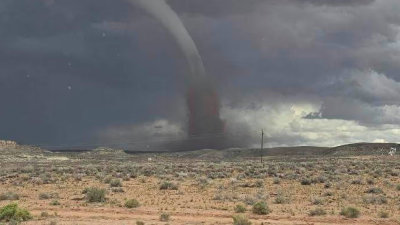
A tornado touched down in the mountains of Davis County just before 2 p.m. on Friday, Sept. 18, according to a preliminary storm report from the National Weather Service in Salt Lake City. The touchdown occurred near a ridge west of Francis Peak at an elevation of approximately 7,500 feet, amidst a severe storm system affecting the region.
Meteorological Confirmation
The National Weather Service confirmed the occurrence of the tornado through a combination of radar data and social media video analysis. By cross-referencing the terrain shown in user-shared footage with local maps, meteorologists were able to pinpoint the location of the touchdown near the mountains east of Fruit Heights.
Minimal Impact Reported
While social media footage captured the tornado lifting fragments of trees, the National Weather Service reported that no damage was recorded. Officials noted that the specific area where the tornado touched down is largely unpopulated, which likely prevented significant impact or destruction.
Severe Weather Conditions
The tornado occurred during a period of intense weather for the area. The National Weather Service had previously issued a severe thunderstorm warning for portions of Weber and Davis counties. This warning included the potential for damaging wind gusts, hail, heavy rain, and flash flooding.
Regional Storm Damage
The storm system produced several other weather-related incidents across the region on Friday, Sept. 18. In Layton, a Men's Wearhouse store sustained damage during the storms. Additionally, residents reported large hail and observed streets becoming flooded by water for several minutes during the heavy rainfall.
Rare Climatic Event
The occurrence of a tornado in this specific area is considered a rare event given the local climatology. The storm system's impact was part of a broader weather event that brought significant rain and wind to northern Utah.