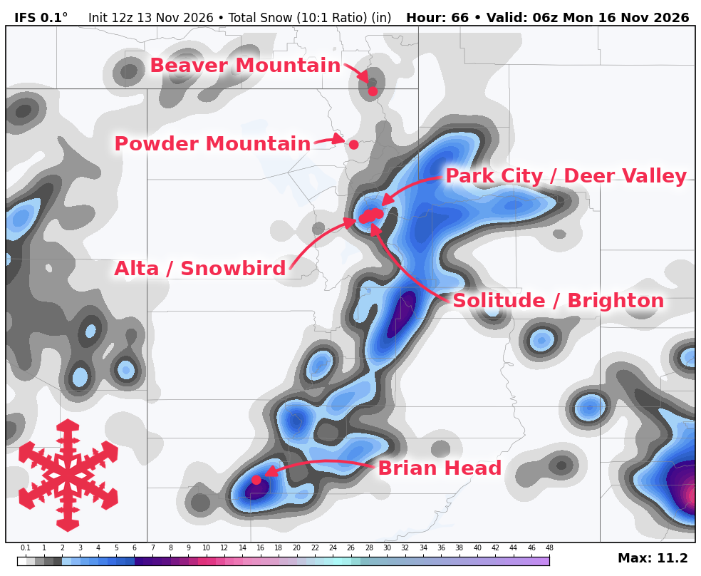
Utah’s snow forecast calls for an ongoing storm to build mountain coverage through Saturday, November 14, 2026, according to a November 13 report from WeatherBrains. The largest remaining accumulations are expected at Brian Head and in the upper Cottonwoods.
Snow is expected to continue at Brian Head on Friday, November 13, 2026, as precipitation becomes more widespread across northern Utah. A cold front arriving Saturday morning, November 14, 2026, is expected to drop snow levels from approximately 8,500 to 9,000 feet down to 6,000 to 7,000 feet as precipitation tapers. While lower bases may initially see rain or mixed precipitation, higher terrain is expected to collect a moderately dense layer that becomes less dense as temperatures cool. Southwest gusts between 35 and 45 mph could redistribute snow at Brian Head before winds ease on Saturday, November 14, 2026.
Forecasted snowfall totals for the period of Friday, November 13, 2026, through Sunday, November 15, 2026, include 8-10 inches at Brian Head, 7-9 inches at Alta, and 7-9 inches at Snowbird. Other projected totals include 6-8 inches at Brighton, 5-7 inches at Solitude, 4-6 inches at Park City, 3-4 inches at Deer Valley, 3 inches at Powder Mountain, and 1 inch at Beaver Mountain. None of the resorts mentioned are currently open for skiing, and Brian Head’s opening remains postponed.
The current storm is expected to wind down Saturday afternoon and evening, with light lingering showers possible in the Cottonwoods on Sunday, November 15, 2026. A substantial break is expected Sunday, November 15, 2026, and Monday, November 16, 2026, as daytime temperatures recover into the 30s and lower 40s at many elevations. Another storm with broad support is expected around Tuesday, November 17, 2026, followed by a potential system around Thursday, November 19, 2026, or Friday, November 20, 2026.
While the current pattern favors a weekend break, a subsequent system later next week may bring more wintry accumulation. The exact track and intensity of systems arriving after Tuesday, November 17, 2026, remain uncertain, particularly regarding the balance between northern and southern Utah.