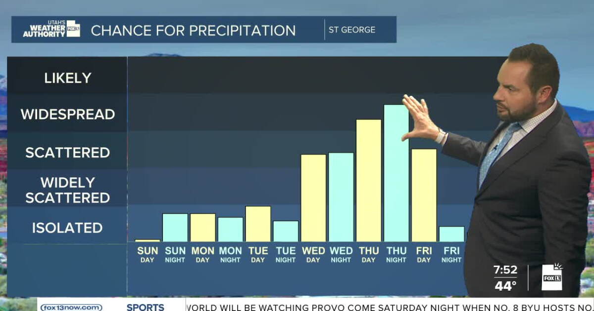
Isolated showers and thunderstorms are expected to return to far southern Utah starting late Sunday morning and continuing into Sunday evening, according to a National Weather Service forecast discussion. Widespread precipitation is anticipated to develop Wednesday morning, impacting much of the region through the weekend.
Most areas are expected to receive between 0.50 and 1.50 inches of precipitation by Friday evening, with some locations potentially seeing amounts in excess of 2.00 inches. Snow levels are forecast to remain above 9,000 to 9,500 feet through Friday morning, before dropping to near 8,000 to 8,500 feet by Friday evening. For elevations above 9,500 feet, total snow accumulations of approximately 4 to 8 inches are possible by Friday evening.
The precipitation pattern is expected to begin with moisture advection reaching southern Utah by late Sunday morning due to an upper level low near the southern California coast. While an upper level trough is expected to dig down the California coast Tuesday, a broad upper level diffluence is anticipated across much of Utah by Wednesday morning. Although a dry slot may build into Utah by Wednesday afternoon, precipitation may continue through at least the first half of the weekend as several upper level lows rotate through the region.
High pressure currently remains across Utah, resulting in nearly clear skies and temperatures near normal for mid-October. In the eastern Pacific, the remnants of Simon are near the southern tip of Baja California, and Hurricane Trudy is off the southwestern Mexico coast. Additionally, there is a 70% chance of cyclone formation in the next 7 days south of Trudy.