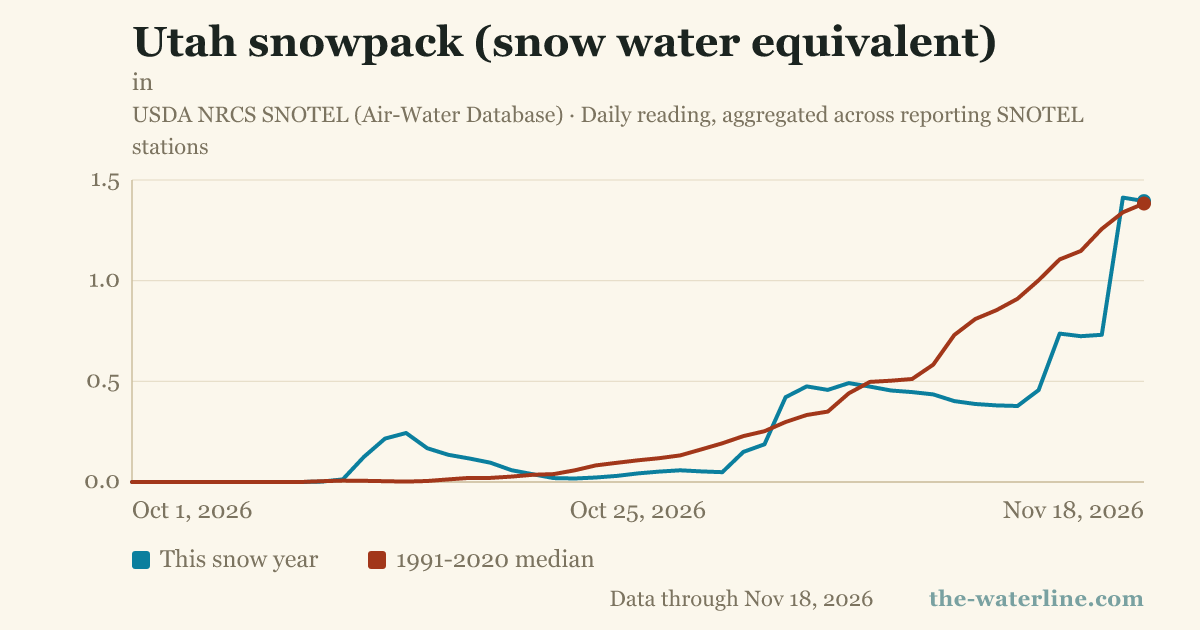
Utah's statewide snowpack measured 1.4 inches of snow water equivalent on November 18, 2026, according to data from the USDA NRCS SNOTEL network. This measurement represents 101% of the 1991-2020 median for that date.
The season's peak snow water equivalent so far was recorded on November 17, 2026, at 1.4 inches. This peak represents 102% of the normal peak of 1.4 inches established by the 1991-2020 median.
Water-year precipitation to date has reached 8.6 inches. This total is 221% of the median precipitation level.
Snow water equivalent (SWE) measures the depth of water held within the snowpack and is used as a predictor for spring and summer runoff. Because depth alone can be misleading, SWE is used because a shallow, dense snowpack can hold more water than a deep, dry one.
The snowpack data is aggregated from daily readings across reporting SNOTEL stations. As of the November 18 reading, 102 stations were reporting data. The calculation uses the standard basin-index method, dividing the sum of current water content across reporting stations by the sum of those stations' 1991-2020 medians.
Snow accumulation typically begins in October, normally peaks near April 1, and melts out by early summer. The reporting of percentage of median changes once the normal snowpack for a specific date nears zero.


