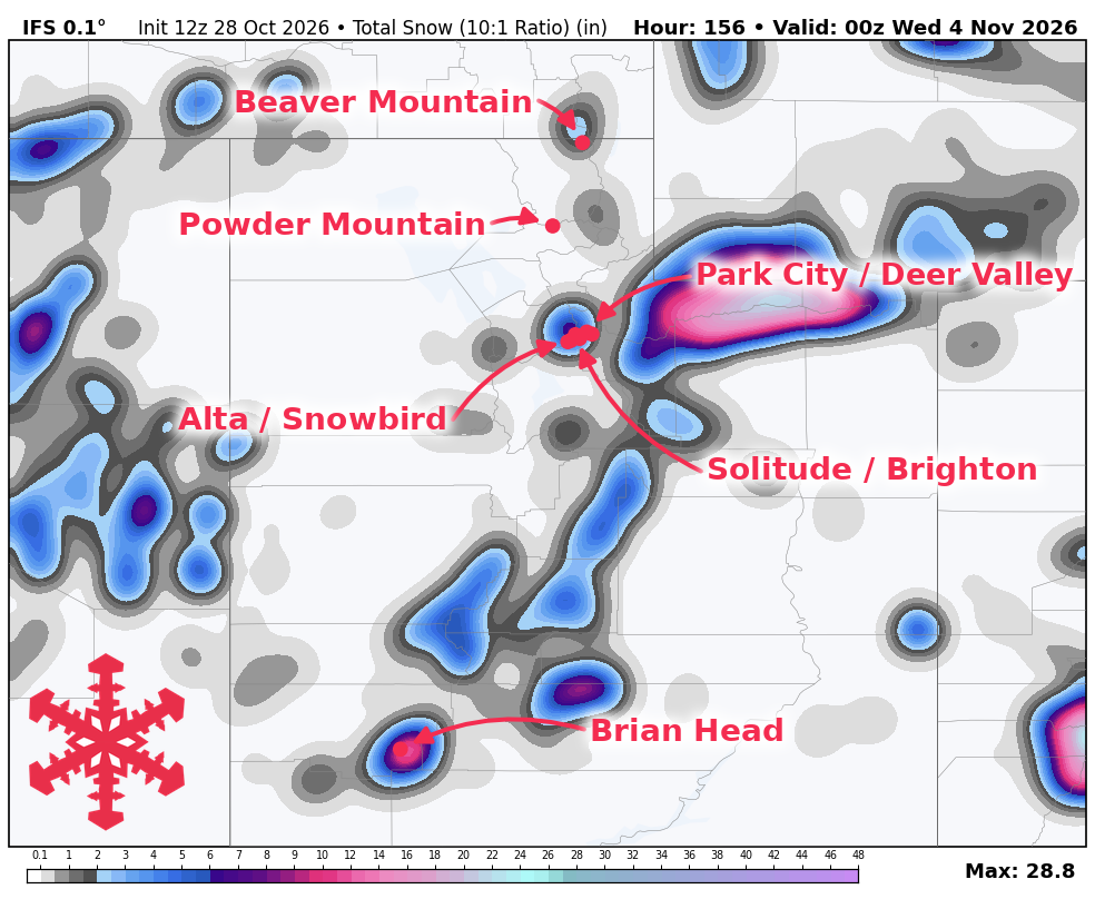
A Utah snow forecast published October 28 indicates that a colder storm arriving Sunday, November 1, and Monday, November 2, will help build the state's early winter base. The storm is expected to bring the best accumulation prospects to Brian Head and within the Cottonwoods.
Initial moisture is expected to arrive with scattered showers on Friday, October 30, mainly across southern and western Utah. Snow levels for these showers are projected to be around 9,500-10,500 feet, which may result in rain or a mix below the highest terrain and dense snow above it. South to southwest winds could produce gusts between 35 and 50 mph over southern high terrain. While showers may ease for a period on Saturday, October 31, moisture is expected to increase again late Saturday into Sunday.
The strongest opportunity for widespread mountain accumulation occurs from Sunday, November 1, into Monday, November 2, as colder air arrives behind the precipitation surge. Snow levels in northern Utah could fall toward 6,500-7,000 feet by early Monday, November 2. While initial snow may be wet and dense, it is expected to become moderately lighter as temperatures settle into the 20s at higher elevations. Brian Head's total accumulation carries uncertainty due to guidance ranging from a glancing event to a much wetter storm.
Forecasted snowfall totals for the period of Friday, October 30 through Tuesday, November 3, include: Brian Head with 12-19 inches, Alta with 10-17 inches, Brighton with 7-12 inches, Snowbird with 7-12 inches, Solitude with 5-9 inches, Park City with 3-6 inches, Powder Mountain with 2-4 inches, Deer Valley with 2-3 inches, and Beaver Mountain with 1-2 inches.
None of the resorts covered in this forecast are currently open for skiing, as the focus remains on building a base. Brian Head's planned opening on Friday, November 6, remains ahead. A drying trend and lighter winds are expected on Tuesday, November 3, followed by a gradually milder stretch.
Confidence in another organized storm drops beyond Tuesday, November 3. While occasional precipitation remains possible later next week, there is little agreement on a substantial follow-up storm.