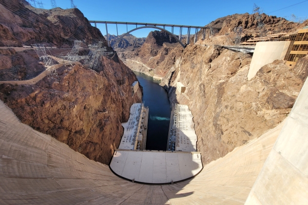
The U.S. Department of the Interior finalized the 2027-2028 Colorado River operating guidelines on Aug. 21, 2026, establishing a 10-year decision framework to manage Lake Powell and Lake Mead. This development follows a July 31, 2026, announcement by the Bureau of Reclamation that released a Final Environmental Impact Statement to guide future management of the river system through 2036.
New Guidelines and Reservoir Lows
The new 2027-2028 guidelines include specific measures to address the unprecedented drought currently impacting the region. According to the Department of the Interior, the combined contents of Lake Powell and Lake Mead have reached levels not seen since before the closure of the gates at Glen Canyon Dam in 1963. Both reservoirs hit record lows during the last few weeks prior to the Aug. 21 announcement.
Managing Lake Powell Elevations
Under the finalized guidelines, Lake Powell will begin the October 1 water year with elevations between 3,540 and 3,510 feet. This range places operations within the Lower Elevation Infrastructure Protection Range. The Bureau of Reclamation expects the water year release for Lake Powell to fall between 6.0 and 7.0 million acre-feet. To maintain an elevation of at least 3,510 feet, the agency will begin the water year with lower releases and adjust them through April.
Mandatory Lower Basin Reductions
The guidelines mandate specific water delivery reductions for the Lower Basin States for each year in the 2027-2028 period. If the Lower Basin States implement their proposed sharing agreement, the annual reductions will be distributed as follows: Arizona will see a reduction of 760,000 acre-feet, California will see a reduction of 440,000 acre-feet, and Nevada will see a reduction of 50,000 acre-feet.
Upper Basin and Voluntary Conservation
In addition to these mandatory reductions, the guidelines allow for voluntary conservation. Lower Basin States may voluntarily conserve and store at least 700,000 acre-feet of water over the two-year period. The framework also provides for Upper Basin States to enter into agreements, in consultation with the Lower Basin and Basin tribes, to use the Secretary's authorities to operate the Colorado River Storage Project Upper Initial Units—specifically the Aspinall (CO), Flaming Gorge (UT/WY), and Navajo (CO/NM) Reservoirs—to help protect Glen Canyon Dam infrastructure.
A Decade of Flexible Management
The decision framework serves as a flexible structure to respond to changing hydrologic conditions. While the framework establishes sideboards—key thresholds and ranges for operational elements—it does not predetermine every specific operating decision. Instead, the Department of the Interior will develop operating plans in two-year increments to allow for responses to changing hydrology.
Balancing Stability and Flexibility
The 10-year Decision Framework aims to balance flexibility with predictability for the 40 million people and millions of acres of farmland that depend on the river. Assistant Secretary for Water and Science Andrea Travnicek stated the plan allows for a new flexibility to respond to changing conditions and potential consensus. The framework prioritizes consensus agreements and voluntary actions while leaving room for future negotiations that could be incorporated into later years of the decade.
Historical Inflow and Use Trends
The necessity of these measures is driven by long-term water shortages. Between 2000 and 2024, water inflows to the system have averaged 12.9 million acre-feet, significantly lower than the 18 million acre-feet estimated in the original Colorado River Compact. Furthermore, the Bureau of Reclamation noted that since 2000, water use has exceeded total system inflow in most years. Recent conditions were exacerbated by the lowest observed snowpack on record during the winter of 2025-2026.