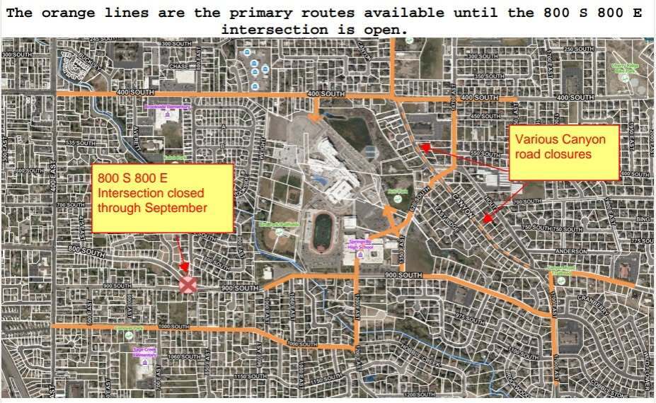
Springville City has released a high school access map to assist students, faculty, transportation staff, and residents as school begins. The map provides guidance for navigating the area during upcoming school activities.
According to a notice from Springville City, solid orange lines on the map represent primary routes available until the intersection of 800 S and 800 E is open.
The notice also indicates that Canyon Road will be closed in sections, as shown by a dotted line labeled various road closures. Depending on which sections are closed, travelers may use Houtz or 1470 E to bypass these areas.
Officials requested that the map be shared with anyone needing to access the high school or those looking to bypass closures to reach locations further away.