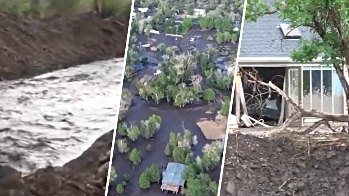
The Cottonwood Fire has grown to consume 97,458 acres near Beaver, Utah, creating a landscape highly susceptible to flash flooding and debris flows as the monsoon season progresses. With 87% of the fire perimeter contained, officials are monitoring the burn scar for increased runoff risks during heavy summer rains.
Cottonwood Fire Status and Growth
According to InciWeb, the Cottonwood Fire began on June 22, 2026, and experienced rapid growth driven by extremely dry fuels and weather conditions that encouraged fire spread. The fire, located approximately five miles east of Beaver, involves a high density of timber and shrubs, including mountain mahogany, manzanita, and shrub oak.
Since July 8, 2026, the Great Basin Complex Incident Management Team #4 has been in command of fire operations. Firefighters have focused on constructing direct containment lines along the perimeter to minimize further acreage loss, supported by air resources. While heavy rainfall has impacted some portions of the fire area, steep terrain and limited access remain significant challenges for crews working to increase containment.
Post-Wildfire Flood Risks
The destruction left by the wildfire creates a secondary set of environmental threats. Utah State University Extension reports that wildfires dramatically alter ground conditions, making the burned earth unable to absorb falling rain. This lack of absorption produces significant runoff, leading to flash flooding and debris flows downstream.
A debris flow occurs when floodwaters pick up rocks, trees, and other organic material from the burn scar. Because these events are often associated with localized thunderstorms during the monsoon season—which spans July through September—there is frequently less than one hour between a storm event upstream and the arrival of floodwaters downstream.
Mitigating Economic and Physical Damage
In Utah, post-fire flooding represents one of the most significant threats from wildfires regarding both property damage and life safety. These flooding events are typically localized, delivering intense rainfall over short durations. Because these storms often occur during the peak of summer and early fall, the window for response is extremely narrow.
To mitigate these risks, Utah State University Extension advises residents and businesses located downstream from a burn scar to prioritize purchasing flood insurance. The agency notes that standard homeowner policies typically do not cover flood damage. Residents can use FEMA’s individual Flood Insurance Rate Maps (FIRMS) to make informed decisions regarding the structural and financial protection of their property.
Essential Emergency Preparations
Preparation for potential flooding involves several critical steps for homeowners. The University Extension recommends creating a family plan that identifies specific hazards, locates the safest room in the house, and establishes escape routes. Families should also designate an out-of-state contact person to serve as a single point of communication if members become separated.
Property owners are encouraged to secure important documents, such as insurance policies and property inventories, in waterproof containers or safe deposit boxes. Physical preparations include clearing debris from gutters and downspouts, ensuring sump pumps are functional with battery backups, and even using sandbags to redirect water. When filling sandbags, experts suggest a two-person method where one person holds the bag upright while another shovels sand until it is two-thirds full.
Safety During Active Flooding
During an active flood event, authorities urge extreme caution. Utah State University Extension warns against walking through moving water, noting that just six inches of current can knock an adult off their feet. Similarly, driving into flooded areas is highly dangerous, as as little as one to two feet of water can sweep a vehicle away.
Residents should monitor NOAA Weather Radios for emergency alerts and avoid low-lying areas such as canyons, drainage channels, and streams that are prone to sudden rises. If there is any chance of flash flooding, officials advise moving to higher ground immediately without waiting for an official warning.