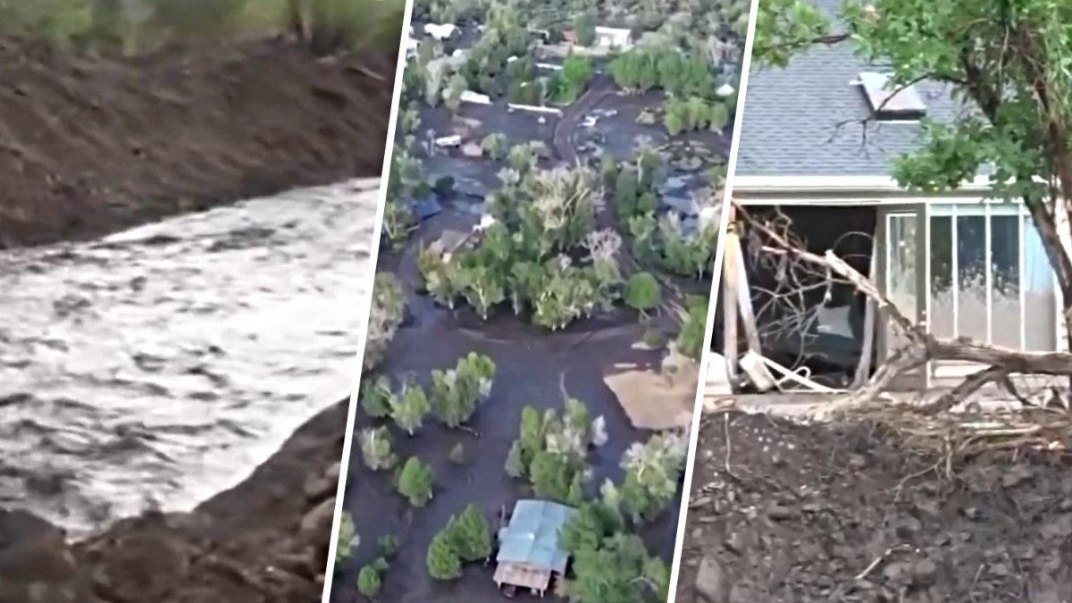
The Cottonwood Fire has expanded to 97,458 acres as fire officials and Beaver County authorities monitor increasing risks of flooding and debris flows. While containment for the blaze reached 77% as of July 14, 2026, local officials have issued a flood preparedness alert for residents due to changing environmental conditions following the massive wildfire.
Fire Growth and Containment Status
The Cottonwood Fire, which first ignited on June 22, 2026, has seen rapid growth driven by extremely dry fuels and weather conditions conducive to fire spread. According to InciWeb, the fire's cause remains under investigation.
Ongoing Firefighting Challenges
As of July 14, 2026, the fire has burned a total of 97,458 acres. Firefighting efforts are currently being led by the Great Basin Complex Incident Management Team (CIMT) #4, which officially took command of the incident on July 8, 2026, at 6:00 a.m. Under the direction of Incident Commander Steve Shaw, crews are working to establish direct containment lines along the fire perimeter.
InciWeb reported that 77% of the fire's perimeter is currently contained. Despite this progress, significant challenges remain for ground crews, including steep terrain, limited access to certain areas, and weather conditions that continue to pose risks. Air resources also remain active in supporting suppression objectives on the ground.
Fuel Types and Terrain
The vegetation involved in the blaze varies by elevation, contributing to the fire's intensity. At higher elevations, the fire is moving through timber underground, which includes dead down fuels intermixed with standing dead trees killed by insects. At lower elevations, the fuels transition into mountain mahogany, gamble oak, and sagebrush, eventually reaching grasses at the lowest points.
Officials noted that these fuels have been critically dry and are expected to continue drying over the coming days, maintaining high risk for fire activity.
Flood Preparedness and Evacuation Planning
In response to the environmental changes caused by the wildfire, Beaver County issued a flood preparedness alert on July 13, 2026. The county is currently in the process of finalizing floodplain maps to identify every home that may require evacuation should conditions change.
To assist with emergency management, Beaver County officials have directed residents who need to move trailers, RVs, or other property to use the Minersville Lake South Parking Lot next to the pay shack. Officials requested that people do not park in campground campsites to ensure that those areas remain available for visitors and for emergency access.
Community Safety Measures
Beaver County officials held a community flood information meeting on Monday, July 13, 2026, at the Beaver High School Auditorium to discuss the ongoing risks. The county has urged residents to prepare for potential emergencies by photographing and videoing their homes, vehicles, and valuables for insurance documentation.
Residents are also encouraged to sign up for the Beaver County AlertSense system to receive direct emergency flood alerts and evacuation notices. The county emphasized that communication is vital and advised neighbors to check on one another during this period of heightened risk.
Future Coordination and Personnel
The Great Basin Complex Incident Management Team #4 continues to coordinate with the Beaver and Paiute County Sheriffs’ Offices. A primary goal for the management team is to evaluate existing closures and evacuations to determine when it will be safe enough for residents and the public to reenter affected areas.
As of mid-July, 894 total personnel are assigned to the Cottonwood Fire operations.