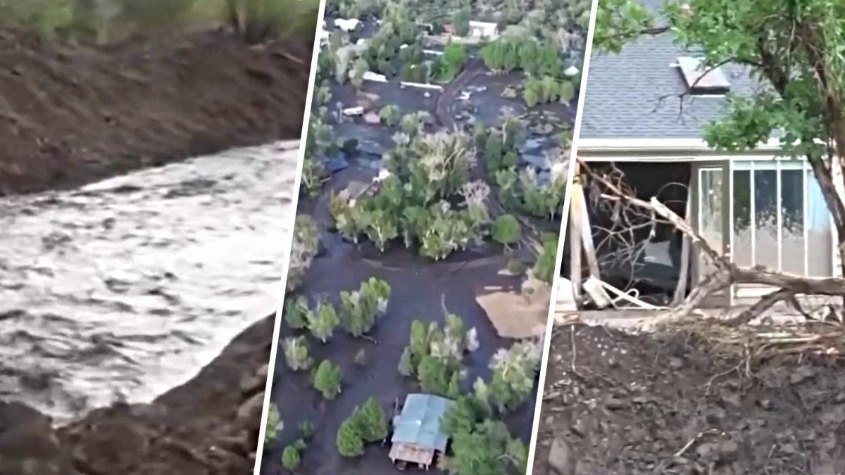
The Cottonwood Fire burned through more than 150 square miles of rugged terrain in Beaver County, prompting the Beaver County Sheriff’s Office to ask property owners to submit formal reports regarding potential losses. The blaze, which swept through parts of a ski resort and along the Beaver River, has left many residents waiting for news on the condition of their homes and land.
Sheriff's Office Seeks Property Reports
The Beaver County Sheriff’s Office announced in a June 24, 2026, alert that officials currently have no information regarding the condition of properties located in the path of the fire. Because the blaze remained highly active, deputies were not yet permitted to enter the canyon to perform structural assessments due to safety concerns.
Official Damage Assessment Process
The Sheriff’s Office stated that its field personnel were strictly dedicated to life safety, active evacuations, and supporting wildland fire crews. The agency noted it was being inundated by hundreds of requests for property checks, a volume of inquiries that officials said was severely slowing down administrative processes and emergency operations.
Guidelines for Property Loss Submissions
To prepare for future assessments, the county requested that property owners submit information through an online Witness Statement portal as if they had already lost property. This data is intended to help officials build an accurate database for when ground crews can safely enter the area.
When submitting forms, the Sheriff's Office instructed residents to label the incident description as "COTTONWOOD FIRE PROPERTY LOSS" in all caps. Owners were asked to provide exact physical addresses, parcel numbers, or GPS coordinates, along with brief driving directions if the property is located on unnamed or private forest roads.
Verification and Future Contact
The county requested that residents provide a one-sentence visual description of any primary buildings, such as specifying if a structure is a "Two-story green A-frame with a silver metal roof." This level of detail is intended to assist ground crews in verifying property status while navigating heavy smoke.
Once forms are submitted, the information will be added to a master Incident Command map. The Sheriff's Office promised that once the Incident Management Team declares a specific sector safe for local law enforcement, teams will check the logged coordinates and contact owners directly via the phone number or email provided.
Satellite Evidence of Burned Landscape
Satellite imagery captured by NASA Earth Observatory highlights the scale of the destruction. A comparison of Landsat 8 and Landsat 9 images shows that on June 5, 2026, the mountainous landscapes appeared green and untouched. However, by June 29, 2026, a large brown patch representing blackened vegetation spanned much of the area northwest of Junction, Utah.
The Cottonwood Fire was identified as one of the largest and most destructive fires in Utah and the United States for the year so as of early July 2026. By July 7, it had burned approximately 150 square miles, making it nearly as large as the Babylon fire located in eastern Utah.
Regional Wildfire Risk Factors
The intensity of the fire follows a period of high wildfire risk across the region. According to NASA reporting, the National Interagency Fire Center had warned that the Great Basin and parts of the Rockies faced an elevated risk for wildfires in July 2026 due to a winter with below-average snowpack and an unusually warm, dry start to the summer.
By July 7, 2026, firefighters were working to contain nearly three dozen large, early-season wildland fires across the western United States. Utah was noted as one of the most active states during this period, with a total of 558 square miles charred by various fires, including four major fires that remained uncontained at that time.
Resources for Fire Updates
For high-level updates on fire acreage and containment lines, the Beaver County Sheriff’s Office advised residents to monitor official Fishlake National Forest feeds or the Watch Duty tracking app. The agency also requested that residents keep phone lines clear for active emergency dispatches and avoid submitting multiple forms for the same parcel of land.