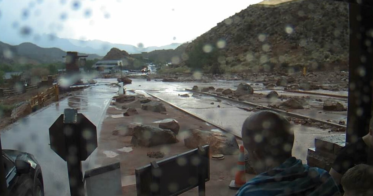
The National Weather Service issued a Flash Flood Warning for parts of Kane and Washington counties on Sunday, October 11, 2026, warning of potentially life-threatening conditions in Zion National Park, Springdale, and Rockville. Thunderstorms producing heavy rainfall triggered ongoing flash flooding across the region, prompting officials to warn of dangerous currents in creeks, streams, and urban areas.
Heavy Rainfall and Flooding
Heavy thunderstorms produced significant rainfall across Southern Utah on Sunday, October 11, 2026. According to KUTV, National Park Service officials reported that between 0.5 and 1 inch of rain had already fallen, resulting in ongoing flash flooding throughout the area.
In a separate report from KJZZ, a river gauge along the Escalante River near Escalante indicated that thunderstorms had dropped between 0.5 and 1.25 inches of rain across the region. This rainfall contributed to flash flooding that was either ongoing or expected to begin shortly in the vicinity of the river.
Warning Areas and Impacted Communities
The Flash Flood Warning issued by the National Weather Service in Salt Lake City remained in effect for various locations until 6:15 p.m. on Sunday, October 11, 2026. The warning area included south-central Garfield County and northeastern Kane County, specifically targeting the Escalante River, slot canyons along Hole-in-the-Rock Road, and Utah Route 12 between mile markers 58 and 83.
Another portion of the warning, as reported by KUTV, covered west-central Kane County and east-central Washington County. This specific area includes Springdale and Rockville, and encompasses an estimated population of 1,741 people and one school.
Safety Warnings for Residents and Visitors
Weather officials warned that the flooding conditions could be life-threatening in various environments, including creeks, streams, urban areas, highways, streets, and underpasses. The National Weather Service cautioned that even in areas where it is not currently raining, people must remain alert, as distant rainfall can rapidly transform dry washes, streams, and rivers into dangerous, fast-moving currents.
Specific safety advisories were issued for different groups of people. Hikers and campers were advised to avoid streams and creeks entirely. Drivers were explicitly cautioned not to attempt to cross flooded roads, as the conditions in creeks and underpasses present significant risks.
Regional Flood Watch
The flash flooding on Sunday, October 11, 2026, occurred while much of Southern Utah was already under a flood watch advisory. This advisory was scheduled to remain in effect through the end of Thursday night.
Regional Weather Patterns
The weather event was part of a broader pattern of storm activity in the region. Other reported weather-related warnings included a Flash Flood Warning issued for the Forsyth Fire burn scar in Washington County and a Flash Flood Warning triggered by heavy rain near Goblin Valley in Emery County.